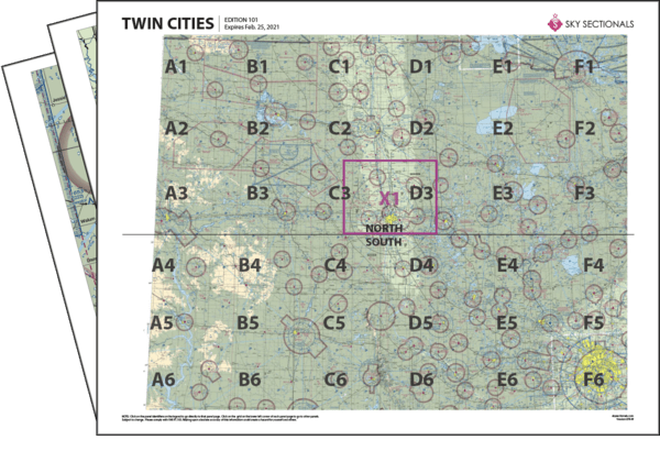
- Downloadable PDF so you can print your own sectional panels
- 36 SkySectional panels covers both the north & south Twin Cities sectional.
- Includes all legend, frequencies, airspace and sectional advisory information.
- SkySectional QuickNav to easily find the panels needed for your flight.
Twin Cities
- Covers Eastern North Dakota, Northwestern Minnesota and Northeastern South Dakota
- Highest terrain elevation: 2550 feet
Charts valid from Apr 17, 2025 to Jun 12, 2025
| $9.99 | ||
| $5.99 | ||
| $13.99 | ||
| Subscribe & Save | $29.99/yr |
Twin Cities Sectional Towered Airports
- ANE - Anoka County-blaine Arpt(janes Field)
- BIS - Bismarck Muni
- FAR - Hector Intl
- FCM - Flying Cloud
- GFK - Grand Forks Intl
- MIC - Crystal
- MSP - Minneapolis-st Paul Intl/wold-chamberlain
- RDR - Grand Forks Afb
- RYM - Ray S Miller Aaf
- STC - St Cloud Rgnl
- STP - St Paul Downtown Holman Fld

