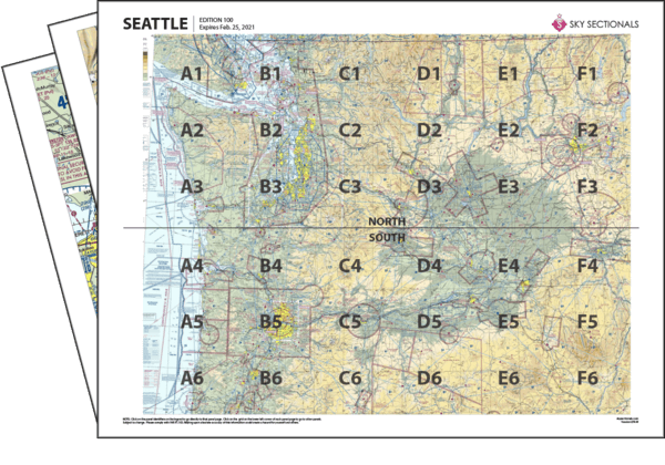
- Downloadable PDF so you can print your own sectional panels
- 36 SkySectional panels covers both the north & south Seattle sectional.
- Includes all legend, frequencies, airspace and sectional advisory information.
- SkySectional QuickNav to easily find the panels needed for your flight.
Seattle
- Covers Washington State & Northern Oregon
- Highest terrain elevation: 14410 feet
Charts valid from Oct 31, 2024 to Dec 26, 2024
$9.99 | ||
$5.99 | ||
$13.99 | ||
Subscribe & Save | $29.99/yr |
Seattle Sectional Towered Airports
- ALW - Walla Walla Rgnl
- BFI - Boeing Field/king County Intl
- BLI - Bellingham Intl
- GEG - Spokane Intl
- GRF - Gray Aaf
- HIO - Portland-hillsboro
- LWS - Lewiston-nez Perce County
- MWH - Grant Co Intl
- NUW - Whidbey Island Nas /ault Field/
- OLM - Olympia
- PAE - Snohomish County (paine Fld)
- PDT - Eastern Oregon Rgnl At Pendleton
- PDX - Portland Intl
- PSC - Tri-cities
- RNT - Renton Muni
- SEA - Seattle-tacoma Intl
- SFF - Felts Field
- SKA - Fairchild Afb
- SLE - Mcnary Fld
- TCM - Mcchord Afb
- TIW - Tacoma Narrows
- TTD - Portland-troutdale
- YKM - Yakima Air Terminal/mcallister Field
Seattle Sectional Class B Airspace
- SEA - Seattle-tacoma Intl
Seattle Sectional Class C Airspace
- GEG - Spokane Intl
- NUW - Whidbey Island Nas /ault Field/
- PDX - Portland Intl
- SKA - Fairchild Afb