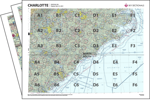
- Downloadable PDF so you can print your own sectional panels
- 36 SkySectional panels covers both the north & south Charlotte sectional.
- Includes all legend, frequencies, airspace and sectional advisory information.
- SkySectional QuickNav to easily find the panels needed for your flight.
Charlotte
- Covers Eastern South Carolina and Eastern North Carolina
- Highest terrain elevation: 5960 feet
Charts valid from Apr 17, 2025 to Jun 12, 2025
| $9.99 | ||
| $5.99 | ||
| $13.99 | ||
| Subscribe & Save | $29.99/yr |
Charlotte Sectional Towered Airports
- 13NC - Oak Grove Mcolf
- CHS - Charleston Afb/intl
- CLT - Charlotte/douglas Intl
- CRE - Grand Strand
- EWN - Craven County Rgnl
- FAY - Fayetteville Rgnl/grannis Field
- FBG - Simmons Aaf
- FLO - Florence Rgnl
- GSB - Seymour Johnson Afb
- HFF - Mackall Aaf
- HXD - Hilton Head
- ILM - Wilmington Intl
- ISO - Kinston Rgnl Jetport At Stallings Fld
- JQF - Concord Rgnl
- MMT - Mc Entire Jngb
- MYR - Myrtle Beach Intl
- NBC - Beaufort Mcas /merritt Field/
- NCA - New River Mcas /h/ /mccutcheon Fld/
- NJM - Bogue Field Mcalf
- NKT - Cherry Point Mcas /cunningham Field/
- POB - Pope Afb
- RDU - Raleigh-durham Intl
- SSC - Shaw Afb
- VUJ - Stanly County

