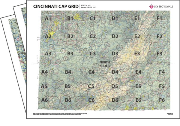
- Downloadable PDF so you can print your own sectional panels
- 36 SkySectional panels covers both the north & south Cincinnati CAP-gridded sectional.
- Includes all legend, frequencies, airspace and sectional advisory information.
- SkySectional QuickNav to easily find the panels needed for your flight.
Cincinnati CAP Grid
- Covers Southern Ohio, Eastern Kentucky, Western Virginia and West Virginia
- Highest terrain elevation: 6285 feet
Charts valid from Apr 17, 2025 to Jun 12, 2025
| $14.99 | ||
| $17.99 | ||
| Subscribe & Save | $39.99/yr |
Cincinnati Sectional Towered Airports
- CKB - Harrison/marion Rgnl
- CMH - Port Columbus Intl
- CRW - Yeager
- CVG - Cincinnati/northern Kentucky Intl
- DAY - James M Cox Dayton Intl
- FFO - Wright-patterson Afb
- GSO - Piedmont Triad Intl
- HLG - Wheeling Ohio Co
- HTS - Tri-state/milton J. Ferguson Field
- ILN - Airborne Airpark
- INT - Smith Reynolds
- LCK - Rickenbacker Intl
- LEX - Blue Grass
- LUK - Cincinnati Muni Airport Lunken Field
- LWB - Greenbrier Valley
- LYH - Lynchburg Rgnl/preston Glenn Fld
- MGW - Morgantown Muni-walter L. Bill Hart Fld
- PKB - Mid-ohio Valley Rgnl
- ROA - Roanoke Rgnl/woodrum Field
- SGH - Springfield-beckley Muni
- TRI - Tri-cities Rgnl Tn/va
- TZR - Bolton Field

